Hikes near Marrakech: Best Day Hikes Chosen by a Berber Guide
 By Khalid, local Amazigh guide12 min read
Hikes near Marrakech, ranked by drive time: Ourika villages and caves, Setti Fatma's falls, Imlil and more, from a Berber guide born here. Come walk with me.
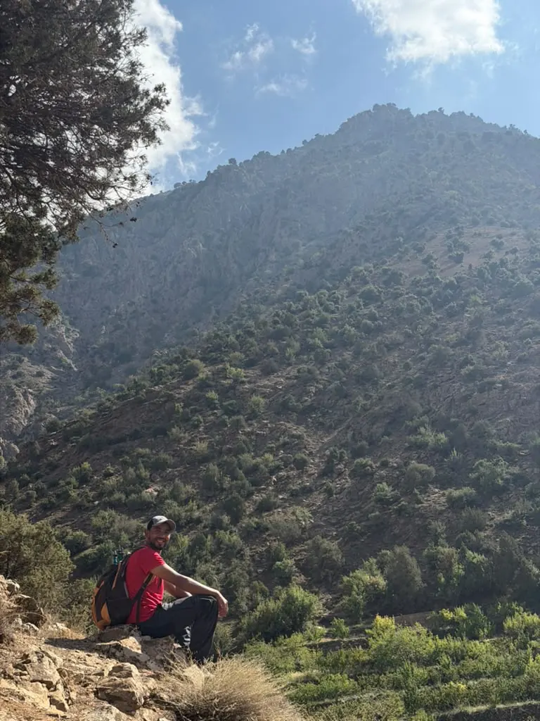
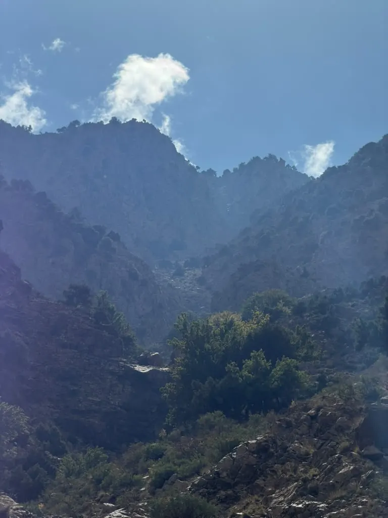
The best hikes near Marrakech are in the High Atlas, about one to one and a half hours' drive south of the city. My honest shortlist: the villages, caves and waterfalls of the Ourika Valley, the seven falls at Setti Fatma, Imlil below Toubkal, and the high pastures of Oukaïmeden, plus a few quiet hills closer in. I was born in the Ourika Valley, so I will tell you which hikes are worth the drive and which ones you can easily do alone.
Quick answer: For your first day hike from Marrakech, go to the Ourika Valley (about 1–1.5 hours by car). Walk to the first Setti Fatma waterfall on your own, or do a 5-hour village and cave loop with a local guide. For bigger mountains, choose Imlil (about 1.5 hours). Ouzoud Falls is beautiful, but it is 2.5–3 hours each way.
My name is Khalid. I am Amazigh, the name we use for ourselves; outsiders often say Berber. This page answers where to go hiking near Marrakech. For how a mountain day works (getting there, pace, food, toilets), read my guide to an Atlas Mountains hike from Marrakech.
Hikes near Marrakech at a glance
Here are the best day hikes from Marrakech, ordered by drive time. All times and ratings are approximate and change with the weather and the season.
| Hike | Drive each way | Walking | Difficulty | Crowds | Guide needed? | Best season | Who it suits |
|---|---|---|---|---|---|---|---|
| Jbilet hills (north) | about 45 min | 3–6 h | Easy to moderate | Very few | Helpful | Oct–May | A quick escape |
| Amizmiz (southwest) | about 1 h | 2–6 h | Easy to moderate | Few | Recommended | Sep–early Jun | Quiet village walks |
| Zat valley (east) | about 1–1.5 h | A few hours | Easy to moderate | Few | Recommended | Spring, autumn | Fewer visitors |
| Ourika villages, caves & waterfalls (my loop) | about 1–1.5 h | 5 h | Moderate | Low | Yes | Spring, autumn | Curious, fairly fit walkers |
| Setti Fatma seven waterfalls | about 1–1.5 h | 20 min to 2 h+ | Short but steep to the first fall, harder above | High | Not for the first fall | Spring, autumn | Everyone |
| Imlil and Toubkal foothills | about 1.5 h | 3–6 h | Moderate to hard | Medium | Yes on Toubkal paths | Spring to autumn | Big views |
| Oukaïmeden | about 1.5 h | 2–6 h | Moderate, high altitude | Low | Helpful | Late spring to early autumn | Rock art, cool air |
| Ouzoud Falls | 2.5–3 h | 1–2 h | Easy, many steps | High | No | Spring | Waterfall lovers |
Want the local's pick? My Villages, Caves & Waterfalls hike is 5 hours of goats, villages, a cave and waterfalls, away from the tour buses. Message me on WhatsApp with your date.
1. Ourika Valley villages, caves & waterfalls loop: the local's pick
- Drive: about 1–1.5 hours to the meeting point. Transport is not included; no car or driver? I can help you organise it.
- Private or shared: both. Solo travellers and couples can join a shared group.
- Walking: 5 hours with stops. My hikes are between 5 and 15 km, depending on the route
- Difficulty: moderate. Village paths, dirt trails, rocky parts, a short scramble at the cave.
- Crowds: low. More goats than tourists.
- Guide needed? Yes. The paths are unmarked and cross village land.
- Best season: spring and autumn; most of my hikes run in these seasons. In summer and winter, ask me on WhatsApp; I may still guide, with early starts in summer. I also guide during Ramadan
- Who it suits: fairly fit walkers, curious people, kids who like bugs (ask me on WhatsApp about younger children). Groups of up to 7 people
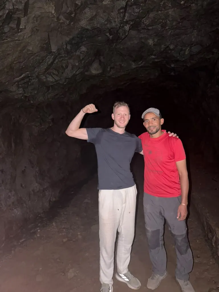
This is the hike I would choose for my own friends. We meet at the bridge near the Maison du Meunier Berbère, the old Berber miller's house (map). We walk through the valley to an Amazigh village, then climb into dry hills that look more like desert than the Atlas. Goats watch you. Villagers say hello. Then comes the cave: dark, cool, and home to bats and some very big beetles. We finish at the waterfalls and walk back to the miller's house.
A recent group did exactly this loop in October 2026. They met goats on the desert-like hills, talked with villagers, found a bat in the cave and saw some giant beetles. One of them even held a huge bug. They laughed most of the day. Honestly, that is a normal day here.
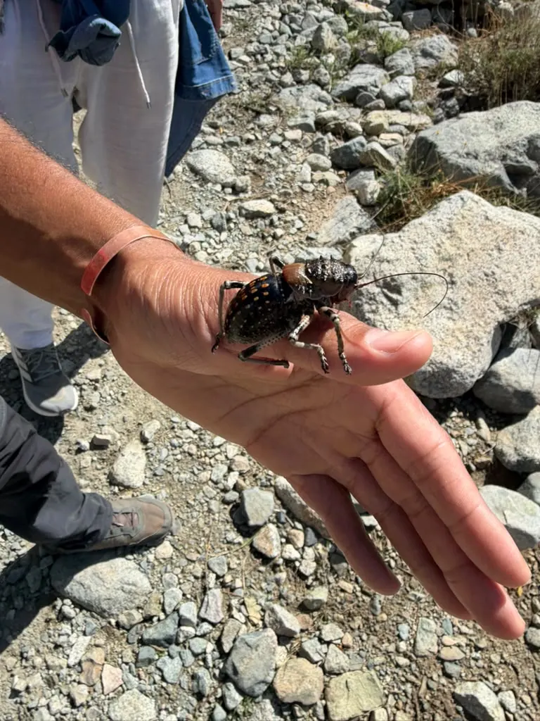
(This big one is most likely an armoured cricket, not a beetle. My guests just called it huge.)
For the full route and the other paths in my valley, read my Ourika Valley hike guide.
2. Setti Fatma's seven waterfalls: the famous one
- Drive: about 1–1.5 hours (around 60–65 km)
- Walking: about 20 steep minutes to the first and biggest fall; about another hour of hard walking to the highest
- Difficulty: short but steep to the first fall; scrambling above
- Crowds: high at weekends and in summer
- Guide needed? Not for the first fall. Follow the blue arrows.
- Best season: spring (fruit trees in blossom) and autumn; in summer, go early
- Who it suits: everyone for the first fall; confident scramblers above
Setti Fatma is the last village on the paved road, at roughly 1,500 metres, and most Ourika day tours stop here. My honest truth: you do not need a guide for the first waterfall. Once you are in the village, the path has blue arrows. Locals will still offer to guide you; travel guides put their asking price at roughly 100–150 MAD just to the first fall (as reported in 2026). To go higher, use the official guides' office on the main street and agree the price first.
Marrakech families come at weekends, and in summer the riverside cafés fill up. Come on a weekday, start early, and it feels much calmer. My Setti Fatma waterfalls guide explains each cascade.
3. Imlil and the Toubkal foothills: bigger mountains
- Drive: about 1.5 hours (around 60 km)
- Walking: 3–6 hours
- Difficulty: moderate to hard; Imlil sits at about 1,740 metres
- Crowds: medium; it is the base for Toubkal treks
- Guide needed? Yes on the Toubkal paths; a good idea elsewhere
- Best season: spring to autumn; higher paths get snow in winter
- Who it suits: fit walkers who want big views
Imlil is the main base for trekking near Marrakech. It sits west of my valley, on the other side of the mountains, below Jbel Toubkal (4,167 metres), the highest mountain in North Africa.
For an Imlil waterfall hike, you have two choices. The short one is a gentle walk from the village to small cascades, usually given as around 30 minutes, past walnut trees and orchards. The long one climbs through Aroumd (about 1,840 m) to the shrine and waterfall at Sidi Chamharouch (roughly 2,300 m). That is most of a day there and back, roughly 5–7 hours with stops.
Toubkal is not a day hike. Most people take two days, with a night in a refuge at about 3,200 metres. Since around 2018, visitors have needed a licensed mountain guide on the Toubkal routes. In 2021, police checkpoints were reported at Aroumd, Sidi Chamharouch and the refuge, so you may be asked for a guide on the long waterfall walk too. Rules change, so check before you go.
4. Oukaïmeden: high pastures and 4,000-year-old rock art
- Drive: about 1.5 hours (around 70–80 km), up a side road from the Ourika Valley near Aghbalou
- Walking: 2–6 hours
- Difficulty: moderate; the air is thinner up here
- Crowds: low for walkers; busiest when there is snow
- Guide needed? Helpful; the engravings are spread out, some off the path
- Best season: late spring to early autumn for walking; winter for snow
- Who it suits: history lovers, anyone escaping the heat
Oukaïmeden is a ski resort, with slopes between about 2,600 and 3,200 metres. When the snow goes, it is high pasture again. More than a thousand engravings of daggers, halberds, shields, animals and people are pecked into the sandstone here, many around 4,000 years old. When Marrakech is baking in summer, this is one of the coolest places for hiking around Marrakech.
5. Quieter hikes close to Marrakech: Jbilet, Amizmiz and the Zat valley
Want hiking trails near Marrakech with almost nobody on them? Try these three.
- Jbilet hills: low, rocky granite hills north of the city, about 45 minutes away. Walks of 3–6 hours, mostly gentle; the climb to the Antar summit is the hard one. A 4x4 helps on the tracks. Too hot in summer: go October to May.
- Amizmiz: a market town about 55 km south-west, roughly an hour away. Easy to moderate village walks of 2–6 hours, best from September to early June.
- Zat valley: east of Ourika. Drive to Aït Ourir (about 33 km east of Marrakech), then follow the Zat river south towards Tighedouine, about 30 km more. Count on roughly 1–1.5 hours, and check the road locally. It feels like my valley with far fewer visitors. Lonely Planet's French site suggests the Zat for summer, when Setti Fatma is crowded.
Waterfall hikes near Marrakech: which one is for you?
Most people looking for a waterfall hike near Marrakech choose between these four. French-speaking guests often search "randonnée Marrakech cascade" or "randonnée proche Marrakech". Same answer: Ourika is the closest, Ouzoud is the biggest.
| Waterfall | Drive each way | Walking | What it is like |
|---|---|---|---|
| Setti Fatma (Ourika) | about 1–1.5 h | 20 min to the first fall | Famous, cafés, busy at weekends |
| My Hidden Waterfalls (Ourika) | about 1–1.5 h | about 4 h hike | Quieter cascades on back paths |
| Imlil cascades / Sidi Chamharouch | about 1.5 h | around 30 min / most of a day | Mountain setting, cooler |
| Ouzoud Falls | 2.5–3 h (about 150 km) | Steep steps down to the base and back up, with viewpoints | 110-metre drop, Barbary monkeys |
Be honest with yourself about Ouzoud. It is one of the most beautiful waterfalls near Marrakech, but it is a viewpoint walk more than a hike, and you spend 5–6 hours in the car. I compare the big three in Ourika vs Imlil vs Ouzoud.
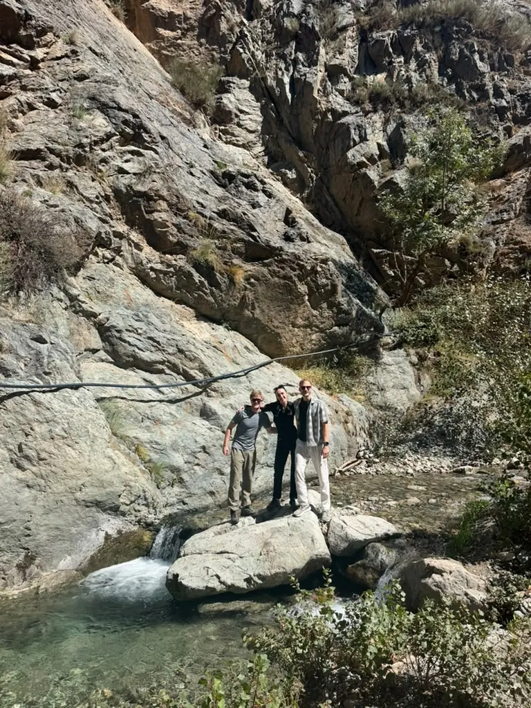
Easy hikes near Marrakech for kids, older walkers and hot days
If you want an easy hike in the Atlas Mountains, try these:
- The first Setti Fatma waterfall: short, but steep and rocky. Slow steps.
- The Imlil cascades: a short walk from the village.
- The shorter Amizmiz walks: about 2 hours, easy.
- My Tea & Tagine at Home walk: about 3 hours, easy, ending with lunch with a village family (lunch is paid separately; ask me about the menu and vegetarian options).
Kids love the goats and caves. Older walkers like the slow pace and tea stops. On hot days, remember Marrakech averages highs of about 37–38°C in July and August. The valley is cooler, but walk early and rest in the shade at midday.
Choosing by fitness and season
Easy: first Setti Fatma fall, Imlil cascades, Tea & Tagine. Moderate: my villages and caves loop, Amizmiz, Zat, Jbilet. Hard: Sidi Chamharouch, the passes above Oukaïmeden, and Toubkal (two days).
| Season | Marrakech (average) | In the mountains | Best hikes |
|---|---|---|---|
| Spring (Mar–May) | about 26°C highs in April | Fruit trees in blossom, mild walking days | Ourika, Imlil, Amizmiz, Zat |
| Summer (Jun–Aug) | about 37–38°C highs | Cooler up high; storms can bring flash floods | Ourika early, Oukaïmeden, Imlil |
| Autumn (Sep–Nov) | about 28°C highs in October | Good walking weather | Almost everything |
| Winter (Dec–Feb) | about 19–21°C days, 6–8°C nights | Snow on high peaks, cold in the shade | Jbilet, Amizmiz, lower Ourika |
Summer storms are the real danger in the valleys. On 17 August 1995, a flash flood on the Ourika River left more than 200 people dead or missing. In early August 2025, another flood damaged riverside cafés. If storms are forecast, we change the route or the day.
For cold-season walking, read hiking in Morocco in winter. For how hard a real mountain day feels, see my Atlas Mountains hike guide.
Do you need a guide for hikes near Marrakech?
One honest line per route:
- Setti Fatma, first waterfall: no.
- Setti Fatma, upper falls: helpful. Use the official guides' office.
- My Ourika villages and caves loop: yes. Unmarked paths, private land, and a cave with no signs.
- Imlil and Toubkal: yes, a licensed guide has been required on the Toubkal paths since around 2018 (check current rules).
- Oukaïmeden: helpful for finding the engravings.
- Jbilet, Amizmiz, Zat: recommended. Few paths are marked, and a local opens village doors.
- Ouzoud: no.
The longer answer is in do you need a guide in Morocco?
What to bring on a day hike near Marrakech
- Closed shoes with good grip (rocks near waterfalls are slippery)
- 1.5–2 litres of water per person
- A warm layer, even in summer (it is cooler up high and in the cave)
- Hat and sunscreen
- Cash in small notes for tea, cafés and tips
- Clothes that cover shoulders and knees in villages
- A phone torch or head torch for the cave
Hike with Khalid: which of my four tours fits you
- Villages, Caves & Waterfalls (5 hours, moderate, private or shared): my local's pick. Goats, an Amazigh village, desert-like hills, a cave with bats, waterfalls.
- Hidden Waterfalls (about 4 hours): back paths to quieter cascades, for waterfall lovers who want fewer people.
- Tea & Tagine at Home (about 3 hours, easy): for kids, older walkers and anyone who wants more tea than climbing.
- Full Day from Marrakech: a long day in the High Atlas, with a long trek, a lunch stop in the valley (paid by you), and back to the city by sunset. Transport is not included, but I can help you arrange a ride from Marrakech. Ask me on WhatsApp for the times.
Prices: they depend on how long the hike is. A shared hike is 200–300 MAD per person (about €18–28); I mix and match solo travellers and couples with other walkers on the same day. A private hike is 400–600 MAD for your whole group (about €37–55), so for two or more people, private costs the same as shared or less. You arrange your own transport to the meeting point, about an hour by car from Marrakech; if you have no car or driver, ask me when you book and I can help. Groups are up to 7 people. We agree the price on WhatsApp before the day. The price includes drinking water; lunch, snacks, transport, any entry fees and tips are paid by you. See all four tours on my tours page and the details on my prices page.
Guests rate my hikes 4.9 out of 5 on average. Sterre wrote: "I felt really safe. Khalid helped me do a beautiful hike that I didn't think was possible with my fear of heights, haha!" Read more, or leave your own review, on my reviews page.
Planning day hikes near Marrakech? Tell me your date, how many people, and how much you like to walk. I will tell you honestly which hike fits, even if it is not one of mine. WhatsApp me here or call me on +212 625 015 514. The goats are waiting.
FAQ
What is the best hike near Marrakech?
For most people, it is the Ourika Valley, about 1–1.5 hours away. You get easy waterfalls at Setti Fatma, plus quieter village, hill and cave routes with a local guide. If you are fit and want bigger peaks, Imlil below Toubkal is the other strong choice.
Can you hike the Atlas Mountains as a day trip from Marrakech?
Yes. The Ourika Valley, Imlil, Amizmiz and Oukaïmeden are all about 1–1.5 hours' drive away. That leaves 3–6 hours for walking and gets you back before dark. Toubkal's summit is the exception: it usually takes two days, with a licensed guide.
Is there a waterfall hike near Marrakech?
Yes. The closest is Setti Fatma in the Ourika Valley, where the first of seven waterfalls is about 20 steep minutes from the village. Imlil has small cascades a short walk from the village. Ouzoud Falls is bigger, at about 110 metres, but it is 2.5–3 hours' drive each way.
Do you need a guide to hike near Marrakech?
Not always. You can walk to the first Setti Fatma waterfall or the Imlil cascades alone. Since around 2018 you have needed a licensed guide on the Toubkal paths (check the current rules), and a local guide is the easiest way to find unmarked village paths, caves and quieter waterfalls.
What is the closest place to hike near Marrakech?
The Jbilet hills, north of the city, are about 45 minutes away, but they are low and very hot in summer. For real mountains, the Ourika Valley begins about 30 km from Marrakech and is one of the closest parts of the High Atlas.